Geography and Climate of the Altai Mountains
A high-altitude province defined by the Altai Mountains, permanent snow, and glacier-fed rivers.
🗺️ Geography of Bayan‑Ulgii Aimag
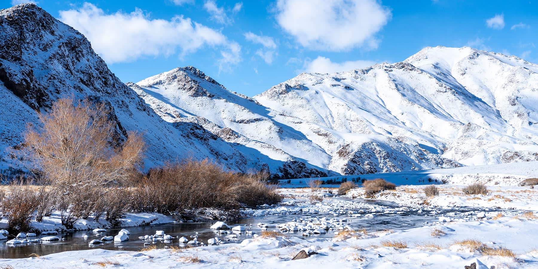
Bayan‑Ulgii Aimag is dominated by the mighty Altai Mountain range, stretching along Mongolia’s southern border with China and gradually descending toward the Great Lakes Depression in the northeast. It is the highest province in Mongolia, with around 95% of its territory lying above 1,600 meters (one mile) above sea level.
- 🏔️ Highest peak: Khuiten Uul – 4,373 m, the highest point in Mongolia
- 🌏 A natural crossroads where Mongolia, China, Russia, and Kazakhstan meet
- ❄️ The only mountains in Mongolia with permanent snow and glaciers
At the westernmost tip of Mongolia rise the legendary Tavan Bogd Mountains, home to the country’s five tallest peaks. To the east stand the dramatic twin summits of the Tsambagarav Mountains, forming another glaciated massif within Bayan‑Ulgii.
Beneath these high peaks lie vast glacier systems—35 glaciers in Altai Tavan Bogd National Park alone, with several more in Tsambagarav Uul National Park. Meltwater from these glaciers feeds many rivers and lakes, including the Hovd River, the longest river in Mongolia.
💧 Lakes and Rivers
- 🏞️ Khurgan Nuur, Khoton Nuur, and Dayan Nuur – three large freshwater lakes within Tavan Bogd National Park that form the headwaters of the Hovd River
- 🌊 Tolbo Lake – a vast, treeless lake in southeastern Bayan‑Ulgii along the road to Hovd
- 🐦 Achit Nuur – the largest lake in the aimag, located near the Uvs border and famed for its enormous bird populations
Away from fertile river valleys, the landscape becomes dry, rocky, and semi‑desert, broken by patches of grassy steppe where nomadic herders graze livestock.
🌦️ Climate of the Altai Mountains
Bayan‑Ulgii has a harsh continental mountain climate, shaped by altitude, dry air, and long winters.
- 🌧️ Mountain precipitation: 200–400 mm annually
- 🌵 River valleys: 100–200 mm annually
- ❄️ Heavy winter snowfall in high mountains—some areas receive over 1 meter of snow
🌡️ Temperatures
- 🧊 Average annual temperature:
- –4°C in the high Tavan Bogd Mountains
- 0°C in Ölgii City
- ☀️ Summer average (July, Ölgii): +14.5°C (57°F)
- ❄️ Winter average (January, Ölgii): –17.8°C (2°F)
Despite its high elevation, Ölgii is often 5–6°C warmer in winter than Ulaanbaatar, thanks to dry air and an open valley setting.
More than half of the annual rainfall occurs in June and July, supporting alpine meadows and summer pastures. Rivers and lakes are typically frozen from October through May, transforming the region into a stark, snow‑covered wilderness ideal for winter tracking and photography.